CanopyBoard: an open benchmark for global canopy height maps
A platform that scores satellite-derived canopy height maps against airborne LiDAR, so researchers and practitioners can see which products to trust, where, and why.
- Client
- Open source
- Sector
- Geospatial & satellite
- Outcome
- Live platform to power the carbon market and global forest conservation efforts
Context
Several global canopy height maps now exist, from Meta and the World Resources Institute, ETH Zurich, and the University of Maryland’s GLAD lab, among others. Each is built from different sensors, training data, and methods. Anyone relying on one to estimate forest carbon, monitor change, or set a baseline has needed a common yardstick for comparing them, and a way to see how each performs in the forests they actually care about.
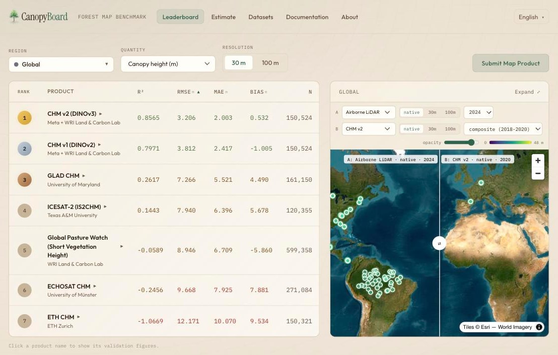
The CanopyBoard leaderboard: products ranked by R², RMSE, MAE, and bias against airborne LiDAR, with a swipe map comparing any product to the reference data.
What we built
Structure. We assembled open airborne LiDAR surveys, including data from NEON and the OpenTopography repository, into co-registered reference data spanning diverse forest ecosystems, organized into validation grids at 30 m and 1 km and grouped by ecoregion.
Analysis. Every product is scored against that reference using standard regression metrics (R², RMSE, MAE, and bias) at pixel, regional, ecoregion, and temporal scales. New maps can be submitted as a GeoTIFF or a cloud-optimized GeoTIFF link and are validated automatically.
Action. A leaderboard ranks the products side by side, and each has a page documenting its sensor, training data, resolution, and coverage. An estimation tool goes a step further: it trains a canopy height model on reference sites, runs yearly predictions from open satellite inputs such as Harmonized Landsat–Sentinel-2 and Sentinel-1, and estimates aboveground biomass from the results.
Built to run without us. Releases deploy automatically from version control through a tested pipeline with fully pinned dependencies, and the interface is available in English, Spanish, Portuguese, and French.
Working on something similar? We’d like to hear about it.
Get in touch →